|
Posted: Oct. 3, 2018 Quick Summary Mostly cloudy, with a small chance of drizzle or light rain. Temperatures starting in the low to mid 40s (F) at race start, topping out in the upper 40s to low 50s by race end. Winds switching from the northeast to more out of the east at about 5-10 mph. Details It has been too long since my last update on TCM, and since then, the forecast has become a lot less uncertain. Last time I plotted a spaghetti plot of the 500-hPa heights from all of the GFS ensemble members showing that there was a trough to the west of the Twin Cities and a ridge to the east, but the exact positions of the cold front and jet stream were really hard to get in the vicinity of the Twin Cities. Since then, the spaghetti plot shows a lot more agreement between ensemble members. 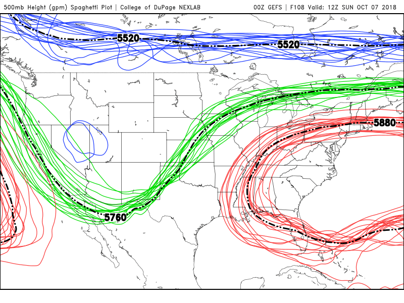 For this reason, we have more confidence looking at a single GFS forecast to get more details about the likely weather for Sunday. Below is a plot of the surface temperature and winds at 7am, just one hour before the starting gun, on Sunday from the GFS. Minneapolis is on the cold side of a stalling cold front (which later becomes a warm front ahead of the next storm system). This means for the Twin Cities metro area, temperatures will be in the low to mid 40s, maybe even some pockets of upper 30s Sunday morning at sunrise, with winds out of the northeast at 5-10 mph. 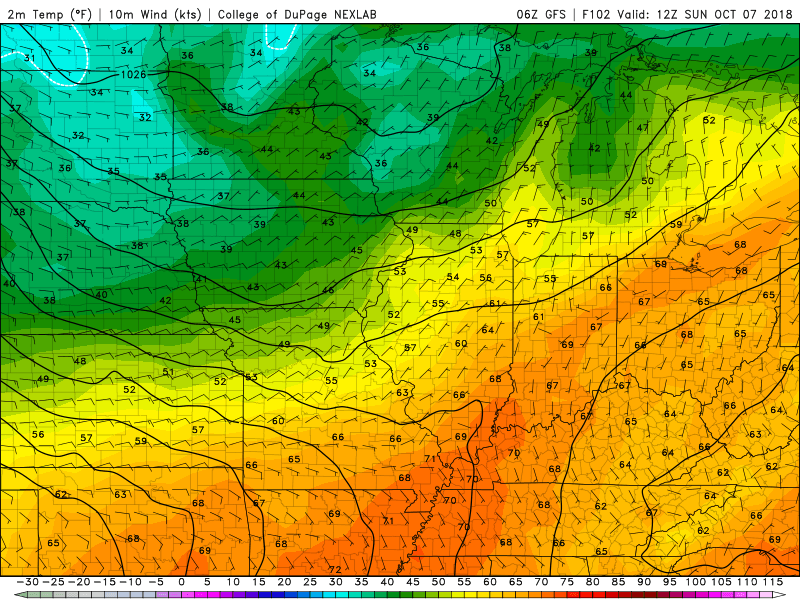 By noon, things have warmed up a tad to the mid to upper 40s, with winds become more easterly at about 10mph. Right now, the models suggest both a low-level cloud deck and potentially high clouds as well, so that's keeping the sun and warmer weather at bay. This is an area where the forecast might be a little less certain and we'll keep an eye on that detail. If the clouds are being overforecast, then it could get slightly warmer toward the end of the race. But clouds seem like a good bet, with even a relatively small chance of drizzle or light rain. After the race, the stalling front becomes a warm front and moves back towards the Twin Cities, with increasing chances of rain later in the day. At the moment, it does not look like this front and rain will get there early enough to impact the race. 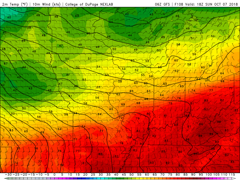 Potential race challenges: While I thrive in temperatures that are as cool as forecasted on Sunday (must by my Siberian blood), it may be on the cool side for some, especially with a slight breeze and with some nonzero chances of drizzle or light rain. Therefore, some racers may choose to wear a warm layer or wind breaker, along with light gloves for those with extremities that are sensitive to cold. Another challenge is that miles 8-15 and 21-26.2 will be going against the wind. This may be refreshing but add a small layer of challenge. But many racers are from the area and are some of the heartiest individuals in the nation, putting up with far worse weather conditions year round. May the cool weather carry you to a fast finish!
-Chris
2 Comments
|
Chris Rozoff and Jesse Sweeney, content contributors.Chris is the expert meteorologist and MVP. Jesse is someone who watched the weather channel a lot as a child and breaks it down for the masses. Chris runs ultras. Jesse runs road and ultras. Archives
April 2019
Categories |
 RSS Feed